|
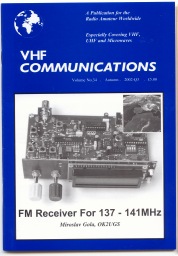
FM
Receiver For 137 - 141MHz
(A
double conversion superhetrodyne with pll)
highly
sensitive and selective superhetrodyne receiver
( SATELIT
METEOSAT 7, NOAA, METEOR, RESURS... )
Miroslav
Gola, OK2UGS
BACK
 [1 ] [2 ]
[3 ] [4 ]
[5 ] [6 ]
[7 ] [8 ]
[9 ] [10 ]
[11 ] [12 ]
[13 ] [14 ]
[15 ] [16 ]
[17 ] [18 ]
[19 ] [20 ]
[21 ]
[1 ] [2 ]
[3 ] [4 ]
[5 ] [6 ]
[7 ] [8 ]
[9 ] [10 ]
[11 ] [12 ]
[13 ] [14 ]
[15 ] [16 ]
[17 ] [18 ]
[19 ] [20 ]
[21 ]
1.
Introduction
Receiving information from FM
meteorological satellites has become an interesting hobby for thousands of
radio enthusiasts all over the world. Those of you who have already tried
internet searches using such keywords as NOAA, METEOSAT, 137.5MHz, WEFAX ,
Meteor etc. , will undoubtedly confirm that they have found hundreds of
links to pages of receiver manufacturers, re-sel-lers, professional users
and particularly ham enthusiasts. You will find among others, a link
to the
homepage of Radek Václavík OK2XDX,
which is devoted to these issues [1]. His
article on a downconverter for Meteosat
reception was published also in the VHF
Communications issue 4/1999 [28,29].
It is worth noting that on 1st April 2000
we commemorated the 40th anniversary
of the first transmission of images from
the satellite TIROS 1. The pictures were
f rather low quality, nevertheless, they
started an era of space research of the
Earth’s surface. The resolving power of
todays images is currently of the order 1
pixel = 1 m. You can find more detailed
information on the internet pages of the
NOAA agency http://www.earth.nasa.
gov/history/tiros/tiros.html .
Quite and few hams tried successfully in
the seventies to construct receivers.
These obviously did not have the technical
specification that can be achieved
with modern components. Images were
not generated using high quality decoding
programs for personal computers,
simply because they did not exist at that
time. The images were “decoded” using
of technology of the seventies; plotting
on oscilloscope with medium afterglow
and then photographing using an instant
Polaroid camera [9].
2.
Looking at earth from space
Satellites
NOAA (USA - National Ocea-nographic
and Atmospheric Administration)
and METEOR, OKEAN, RESURS
(Russia) are the focus in this article.
They are flying on polar orbits around
the Earth at the distance of approximately
800 - 1200 kilometres passing
over the same place at approximately
same time every day [23]. Satellites pass
the North or South pole on each orbit,
that is why their orbits are called polar. It
is possible to determine their trajectory
precisely using “Keplerian elements”,
which describe the current orbit of the
given satellite. Calculation of the exact
time of a satellites orbit, from the moment when it appears at the horizon
till
the moment when it disappears behind
the horizon, can be made nowadays
using many programs for personal com-puters.
I most frequently use a simple
Windows program called SatWin [10,
24]. A version of SatWin was also
written for MS-DOS and can be run on
older personal computers of the DX486
type. Both these programs can be downloaded
free of charge together with up-to-
date Keplerian elements at the following
address: http://www.emgola.cz/. You
will also find other information about the
activities of satellites plus the signals that
you can receive and decode using the
receiver described in the following article.
Pictures are transmitted continuously
from polar satellites without beginning or
ending. When the satellite appears over
the horizon, the edge of the pictures is
slightly cramped, gradually resolution of
details in the picture improves. At the
end of orbit the signal gets weaker and
the picture begins to disappear in noise
as the satellite slips behind the skyline.
Inclination is the angle made by the plane
of satellites orbit and equatorial plane. A
satellite that passes over both poles (on
so called polar orbit) has the inclination
of 90..... The inclination of American
satellites NOAA 10-16 is 98...., their period
is approximately 102 minutes and
height of satellite is approximately 820 -850
kilometres.
Signals from the satellites are in WEFAX
format (Weather Faximile). This is an
old, but still useful, system for transmission
of black and white visual information
using a standard audio channel
where a change of amplitude of the
2400Hz sub carrier represents the level
of the video signal brightness. Maximum
modulation (black) is not zero, but approximately
5%, white is then approximately
87%. This audio signal is frequency
modulated on the main carrier,
e.g. 137.50MHz for the satellite NOAA
15. After demodulation by the FM receiver
we therefore obtain an amplitude
modulated tone of 2400Hz. This signal is
sent to the input of standard sound card
in a PC and processed by a software
decoder such as JVComm32 which can
be downloaded from http://www.jvcomm.
de/ . JVComm32 even handles bad
quality demodulated signals due to the
efficient digital filters. The result of this
processing is shown in Fig 12 as picture
displayed on a computer monitor.
Transmission of images from NOAA
satellites are composed of lines lasting
0.5 second, which correspond with data
from sensors. They provide one picture
of the Earth surface containing data from
two channels. Channel A transmits picture
in the visible spectrum (VIS) and
channel B transmits picture in the infrared
spectrum (IR). Each line contains
time multiplexed data from both channels
and is composed of separation tones
interlaced with picture modulation. Data
from channel A is preceded by and short
impulse of 1040Hz and similarly data
from channel B are preceded by and
short impulse of 832Hz. Each line also
contains a calibration sequence. Thanks
to this the decoding program can display
only the chosen type of picture. You will
find more detailed information at http://
www.noaa.gov/ . You will find up-to-date
information about Russian satellites ME-TEOR,
OKEAN, RESURS at http://sputnik.
infospace.ru/ . These satellites have
higher orbit than that of NOAA satellites
(1200 km). For example inclination of
satellites METEOR is 82° and their period
is 115 min. The system of picture
transmission from METEOR satellites is
compatible, however slightly different,
from that of NOAA satellites. Modulation
is similar, but pictures contain only
one photo with higher resolution. Edges
of lines contain sets of phasing lines
(alternately black and white), the lines
mark end of picture and greyscale. Pictures
in the infrared spectrum do not
contain the greyscale. The pictures are
also inverted as in comparison with
NOAA pictures. Photos from NOAA
satellites show warmer places by darker
shade and colder places are brighter. The pictures from METEOR use inverse
scale
warm seas are white and cold cloud
formations are black.
It is also possible to decode visual information
from the receiver any time. To do
this it is necessary to save the received
modulated signal as a WAV sound file
on a high quality recorder (we had the
best results with SONY Minidisk). If you
take holidays in distant countries, it is
recommended that you use a portable and
easily mounted Quadrifillar Helix antenna,
see [19], take the receiver described
below and a Minidisk. During
your trip you can record exotic pictures
from any of the meteorological satellites.
When you return you can decode the
saved WAV sound files in the same
manner as during direct reception...

[... will issue in
periodical VHF Communications Magazine 3Q/2002 ]
[1] [2]
[3] [4]
[5] [6]
[7] [8]
[9] [10]
[11] [12]
[13] [14]
[15] [16]
[17] [18]
[19] [20]
[21]
|